Users across public, third sector, energy and utility organisations.
OpenMaps supports secure data sharing and practical decision-making.
OpenMaps enables organisations to visualise and share data securely, helping teams make better-informed decisions that improve support for vulnerable communities.
It has developed from an initial focus on vulnerability data into a broader platform supporting socio-economic, environmental, housing, asset and live operational information across desktop and field use.
Organisations using OpenMaps.
A single licence model rather than charging per user.
Support for live operational and planning data where feeds are available.
Platform overview
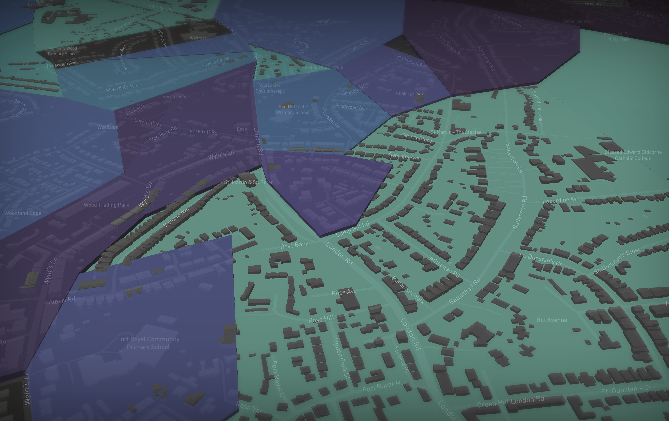
OpenMaps began with a focus on vulnerability data for geographic areas and has expanded into a platform for socio-economic, environmental, housing, asset and operational insight.
Wider access to useful data
Public, private and third sector data can be made available across the business so more teams can unlock efficiencies, insights and better decisions.
Secure sharing and private data hosting
Public data can be viewed widely, while users can host their own private data and choose how it is shared in GDPR-compliant ways.
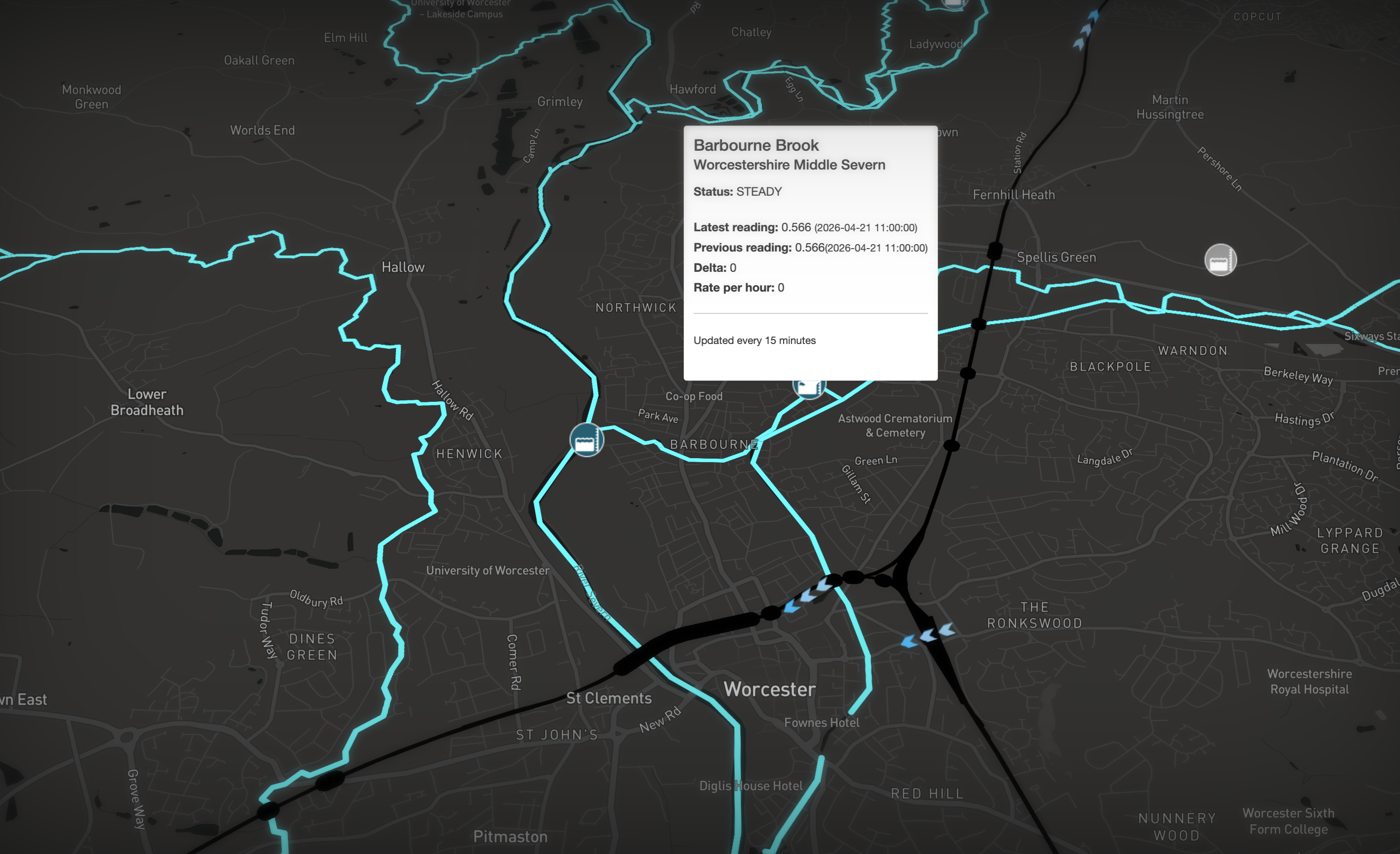
Designed for operational use
Teams can use live data sources, asset histories and map-based workflows to support planning, surveys, incidents and field activity.


From geographic insight to operational support
OpenMaps now supports live power outages, live traffic, weather forecasts, fire incidents and other operational feeds where APIs are available. It can also surface live van locations, network pressures and streetworks video feeds.
Show job history and upcoming surveys for
individual buildings.
View asset data, including footage, directly on
the map.
Support planning work with data for Customer
Impact Assessments and related workflows.
3D, photorealistic and augmented views
Asset data can be explored in a 3D photorealistic model to assess access issues and identify areas of interest. The platform also supports an augmented reality view for engineers using tablets in the field.
Built for office, planning and field teams
Whether teams are in the office, on site or supporting incidents in the field, OpenMaps is intended to keep information visible, accessible and useful.
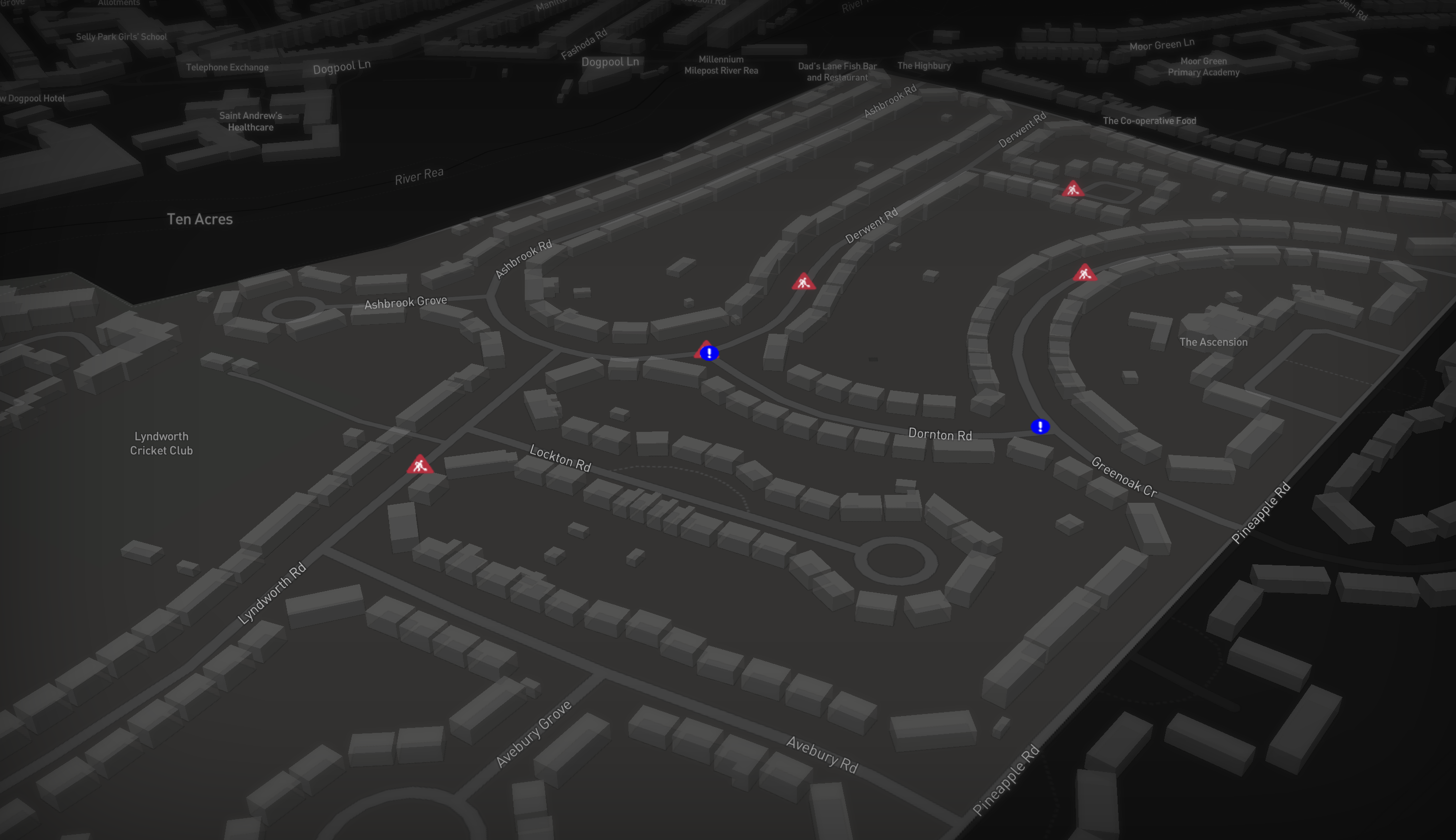
Incident response support
OpenMaps can help incident teams access asset and property information, including estimated PSR data, within seconds of identifying an incident. It also helps identify local amenities, viable base locations, excavation activity and contact workflows through a single web interface.
Colour-code properties by PSR status and time
since last contact.
Track equipment and stock through
spreadsheet-led workflows.
Support external users and volunteers with
secure map access.
Flexible access model
OpenMaps is offered without a per-user licence fee, enabling organisations to deploy it widely and make data accessible to as many people as possible.
How-to videos
Geolocating places in OpenMaps
How to find places and areas in OpenMaps
Viewing data
Using filters to see data about an area in OpenMaps.
Viewing OpenMaps Layers
How to see where things are in OpenMaps.
Exporting data out of OpenMaps
Exporting data from OpenMaps into spreadsheets.
Changing OpenMaps Styles
How to change the type of map you are viewing in OpenMaps.
Changing OpenMaps Colours
Change the colours used by filters in the map.
Frequently asked questions
How much does it cost?
OpenMaps is free to use for as many users as needed for organisations tackling fuel poverty and customer vulnerability.
How can I get access?
Access requests can be directed to access@openmaps.uk.
Are there instructions available?
How-to videos can be linked here from YouTube, with additional guidance and resources added over time.
Can I add my own data?
Yes. Shared data can be added for the wider user group, or private deployments can be discussed for organisation-specific datasets.
Contact
Get access
Email access@openmaps.uk to request access.
For feedback and ideas, use feedback@openmaps.uk.